
Eastern Pacific Stealing Tropical Headlines
Parade of tropical storms and hurricanes continues. Fausto poses Hawaii risk next week

Quiet Atlantic for Now, Subtropics Need to be Watched As We Approach Aug
Aside from Bertha, the Atlantic is expected to remain mainly quiet for the next week. There are signs that tropical wave activity coming off the coast Africa will become stronger from the last couple days of July into the first week of August. Given the very strong upper level westerly winds screaming across the tropical Atlantic (a telltale sign of a strong El Nino), these waves are unlikely to develop east of the Leeward Islands in the eastern Caribbean, but will need to be watched as they gain latitude and reach the subtropical central and western Atlantic, north of the Leeward Islands and Puerto Rico. Upper level winds in this area - as is typical for an El Nino - are expected to be more favorable for tropical development than in the deep tropics.
Hawaii Needs to Keep a Close Eye on Fausto
Meanwhile, in the Eastern Pacific, Hurricane Fausto is a Category One hurricane located about 800 miles off of Baja California, having changed littled in intensity over the past 24 hours. Fausto is expected to slowly intensify over the next day or two, then remain more or less steady in intensity through this weekend.
The main impediment to Fausto becoming stronger is that it is expected to gradually gain latitude over the next few days, eventually reaching cooler waters of around 27C. Light shear and abundant moisture surrounding the system would normally favor more significant intensification, but for now the forecast models are muted and favor Fausto being a Category One or Two through the end of this week.
Fausto has a long way to go before approaching Hawaii - any threat to the Hawaiian Islands is about a week away. If Fausto were to take a more southern route toward the Big Island (as favored by the Google DeepMind ensemble) and remain over warmer waters for longer, it would be more likely to maintain hurricane intensity close to Hawaii. However, if it takes a more northern route (as favored by the European ensemble/EPS) it would be more likely to weaken significantly before approaching Hawaii.
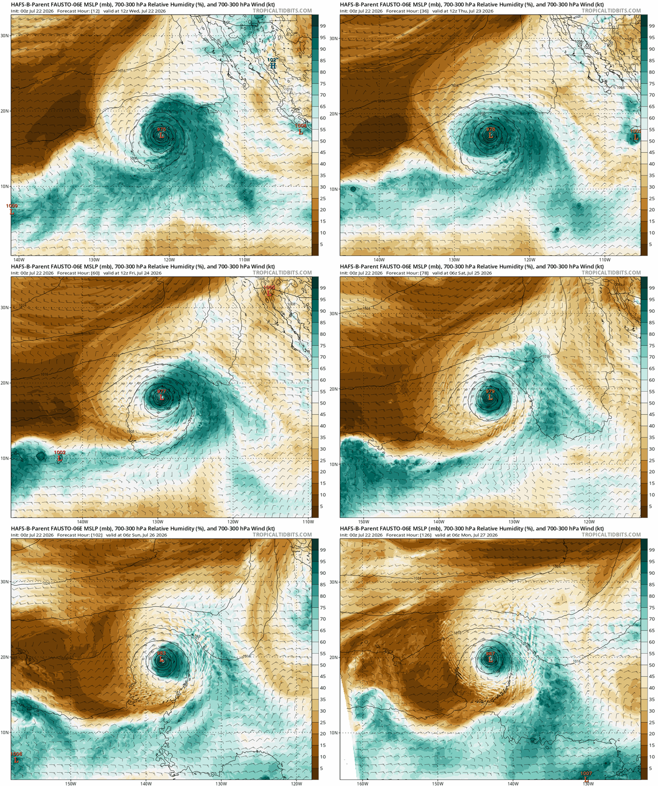
Animation of HAFS-B (specialized hurricane model) forecast mid-level relative humidity and pressure (black lines) through Sun, showing abundant deep moisture surrounding Fausto initially, then a smaller bubble of deep moisture surrounding the hurricane Fri into this weekend.
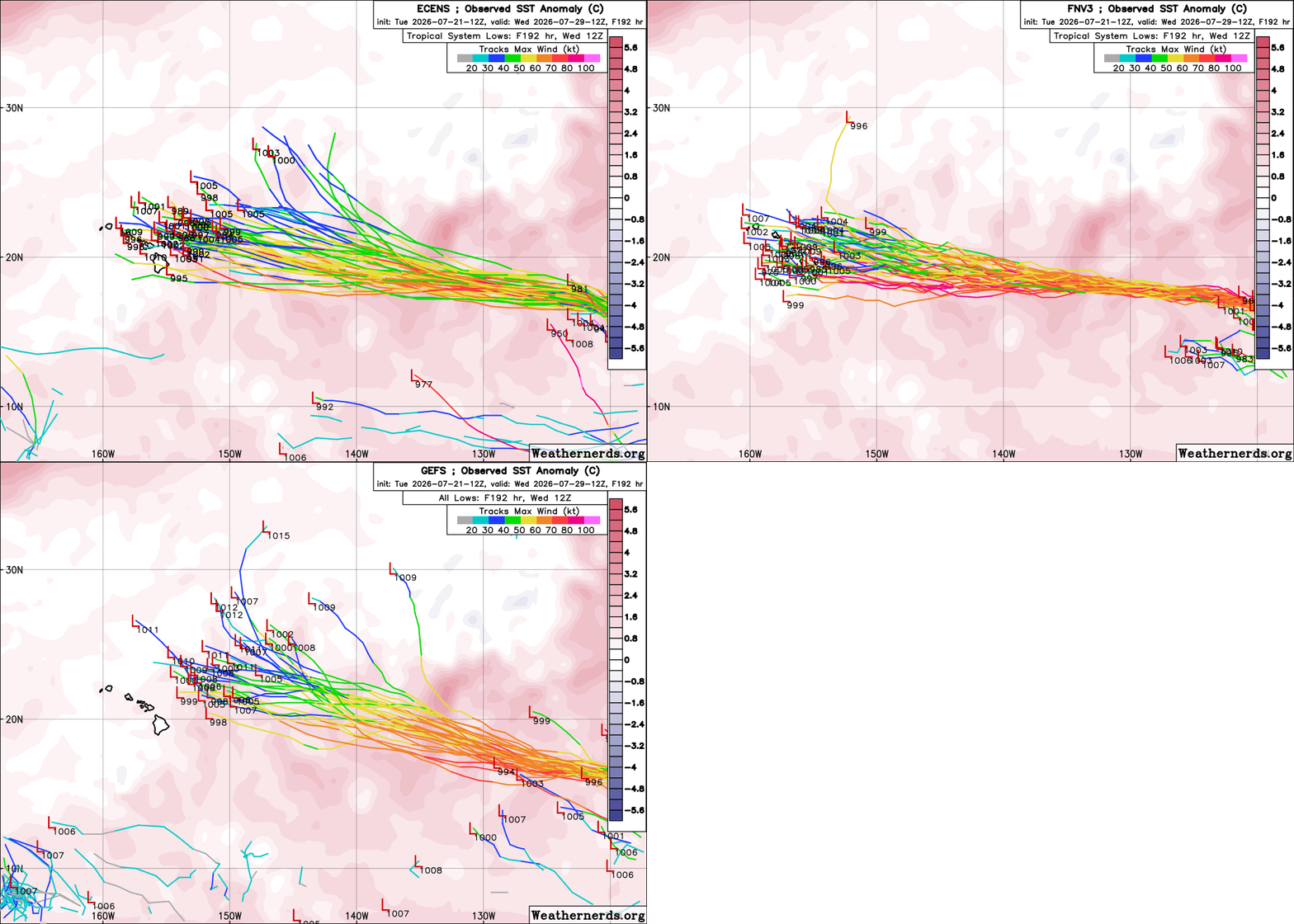
Forecast tracks for Hurricane Fausto through mid-next week from the GEFS, EPS and Google DeepMind (FNV3). While the GEFS indicates Fausto turning west-northwest and passing several hundred miles northeast of Hawaii, The EPS and especially Google DeepMind show a track closer to Hawaii.