
Bertha Gaining Strength, Heading for Louisiana
Resilient Bertha has outpaced intensity forecasts, and may still have surprises up her sleeve

Tropical Storm Bertha, while certain not winning any beauty contests for “Best-Looking Tropical Storm”, has slightly overperformed expectations so far. Hurricane Hunter aircraft found that from midday Monday to midday Tuesday, maximum winds increased from 35 to 60 mph. While technically just short of the minimum bar for rapid intensification in terms of the increase in winds, the pressure drop was far more gradual than we generally see in cases of rapid intensification - about a 10 millibar drop in 24 hours.
Radar and satellite loops on Tue afternoon showed Bertha remained a lopsided storm, with the vast majority of organized thunderstorm activity (deep convection) located on the southern side of the tropical storm, over the eastern Gulf of Mexico. Nonetheless, bands of scattered thunderstorms - accompanied by locally heavy rain - were rotating northward from the west coast of Florida and into the Big Bend, aided by deep tropical moisture transported northward by Bertha’s large circulation.
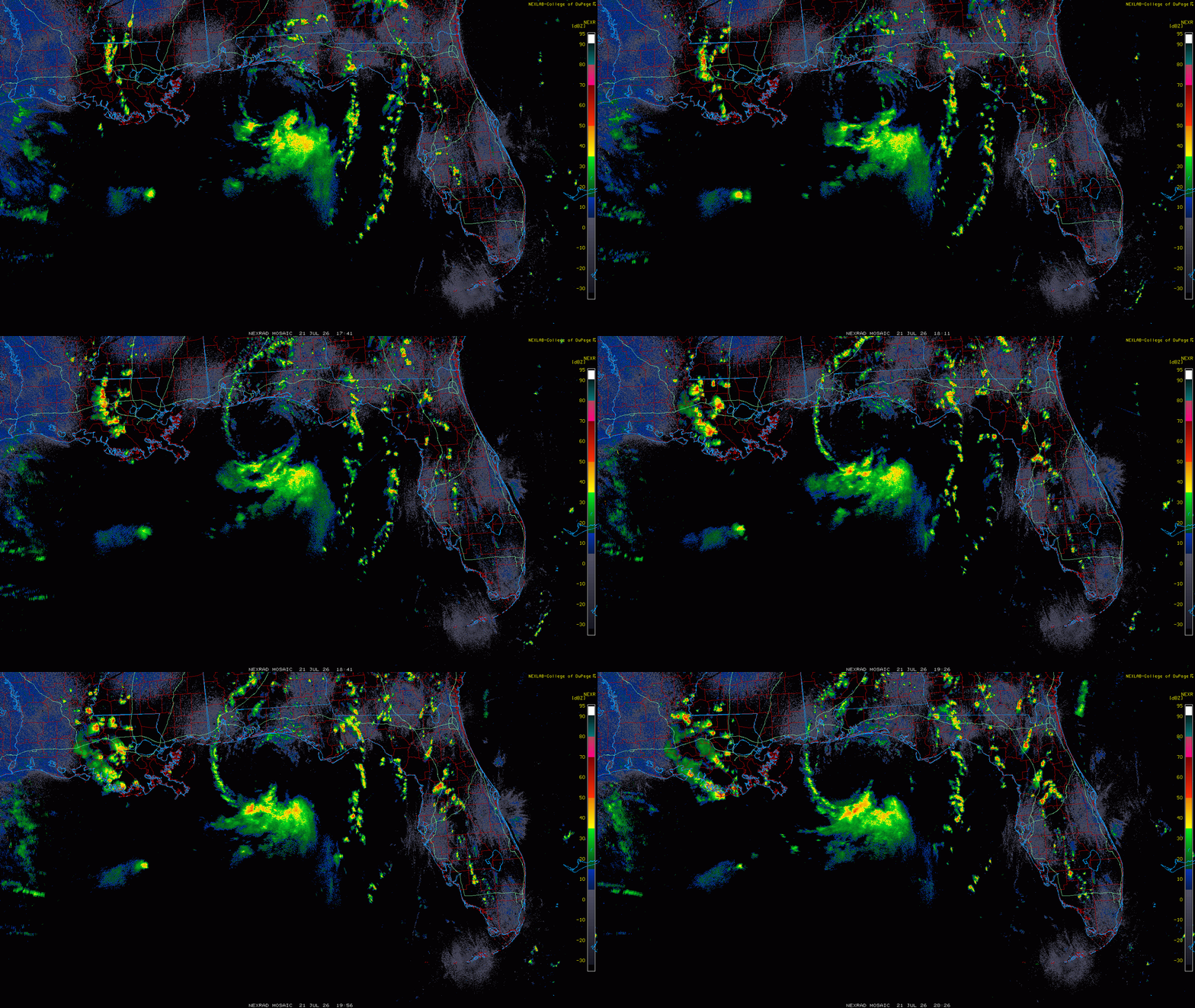
Radar loop from 1 PM to 4:30 PM EST on Mon, Jul 21, showing Bertha’s lopsided circulation, with nearly all of the deep thunderstorms (yellows and orange colors) on its southern side. Credit: College of Dupage Weather Lab
Radar estimates along with on ground observations showed 1.5-3”+ of rain had fallen since Sunday over a wide swath of North Florida from the Big Bend area to the Nature Coast, with locally heavier amounts up to 5” near the coast. While localized flooding occurred near the coast, this rainfall is on the whole quite welcome - music to the ears of farmers and regular folks in this region, which has seen parched soils after several months of persistent dryness.
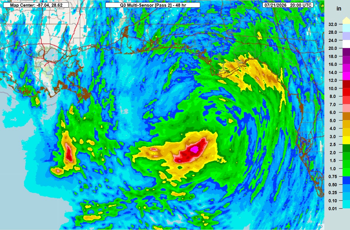
48 hour rainfall ending Tue, Jul 22 at 4PM ET, showing heaviest rainfall along the Nature Coast and Big Bend of northern Florida. Meanwhile, much heavier rainfall on the southern side of Bertha (shown in red and pink colors) remained offshore in the northeast Gulf of Mexico.
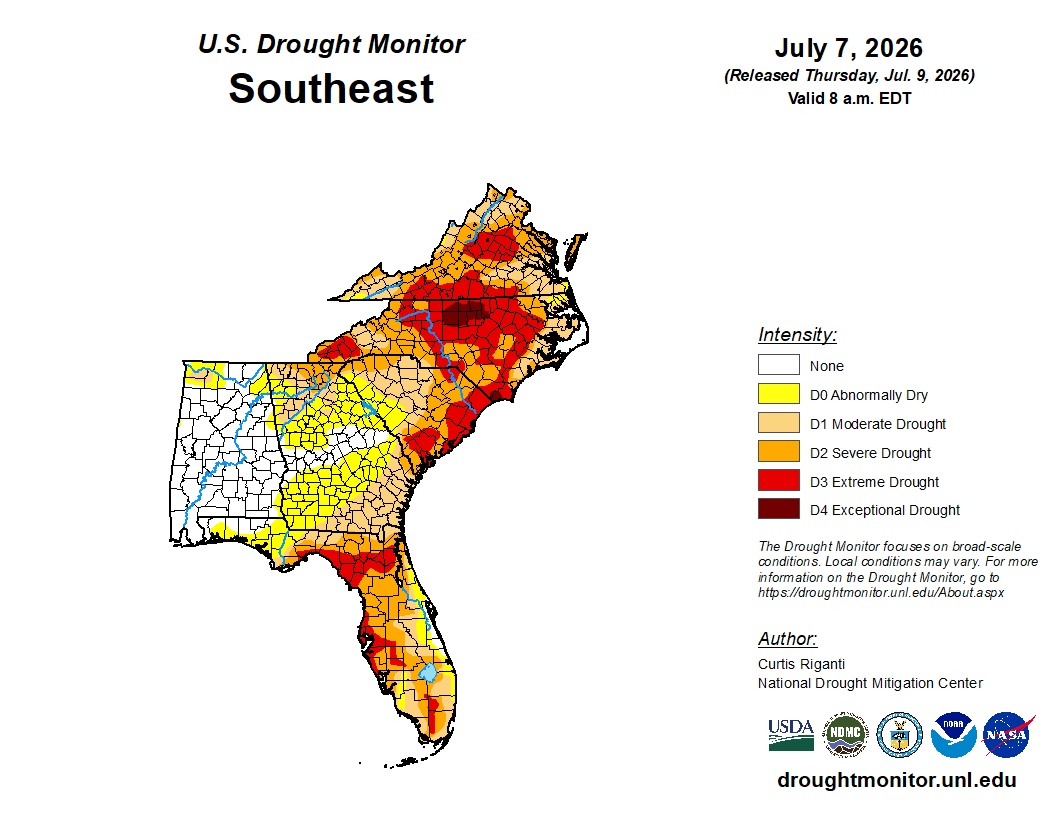
Drought Monitor for the southeast US, showing severe to extreme drought conditions in much of Florida, particularly from the eastern panhandle and Big Bend regions southward to the Tampa and Ft. Myers metro areas. Locally heavy rainfall from Bertha is helping to alleviate drought conditions and replenish soil moisture. Courtesy NOAA/University of Nebraska Lincoln
